Responsible for http://data.bshc.pro/.
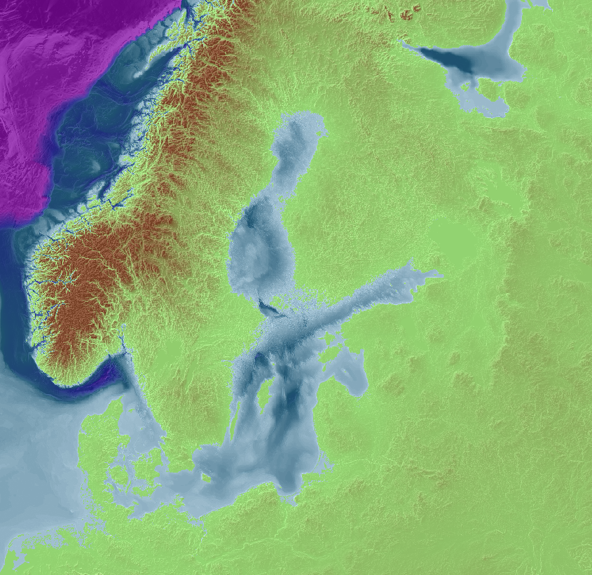
The Baltic Sea Bathymetry Database (BSBD) is an effort to, in one place, gather and distribute bathymetry for the areas of all Baltic Sea countries.
Measuring bathymetry is mostly a national duty for each country, primarily because the production of nautical charts lies within each state’s responsibility. But many use cases span over country borders.
The portal offers free, homogeneous Baltic Sea bathymetry data from “official” sources: All Baltic Sea national hydrographic offices under the umbrella of the Baltic Sea Hydrographic Commission.
OGC services for downloads or use of the bathymetric models as background in GIS systems is also provided.
Terms of Reference
(Approved by the 15th conference 21 – 23 September 2010)
The BSBD-WG shall:
- Study issues related to the access of high density bathymetric data for the entire Baltic Sea area.
- Identify and study the possible differences of existing regulations concerning depth data in the Member states.
- Develop proposals for specification of common harmonized datasets including a common application schema for bathymetry.
- Support the development of the GEBCO and EMODNET Bathymetry initiatives.
- Maintain a structured data storage, view and download services including metadata, in line with the Inspire directive.
- At least one homogenous dataset, based on the delivered datasets from the MS is to be provided in at least 500m resolution. Smaller high resolution datasets may be made available locally where the provided data so allows.
- Provide applicable OGC services from the common datasets.
- Develop proposals for the further steps to develop the database and its services.
- Share experiences and knowledge regarding tools for data dissemination to the public such as, but not limited to, OGC tools and map viewers.
Terms of Reference and Rules of Procedure
Portal Specification
The portal specification used for the work can be found here: Specification V1.0